

Leading the future of defence technology
ABRIS DG is an international defence holding with manufacturing facilities located in Poland, Czech Republic and Ukraine.
We specialise in the design and production of ISTAR UAVs, loitering munitions, UGVs and also pioneering solutions in information technology and energy independence.


Our Products
Our company provides turnkey defence solutions based on experience gained from battle proven unmanned and supporting technology in our product and services.
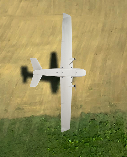
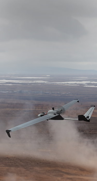
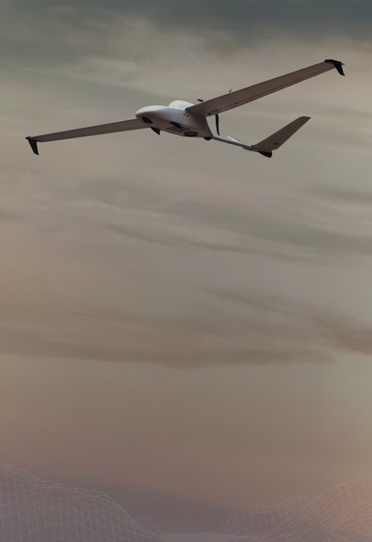
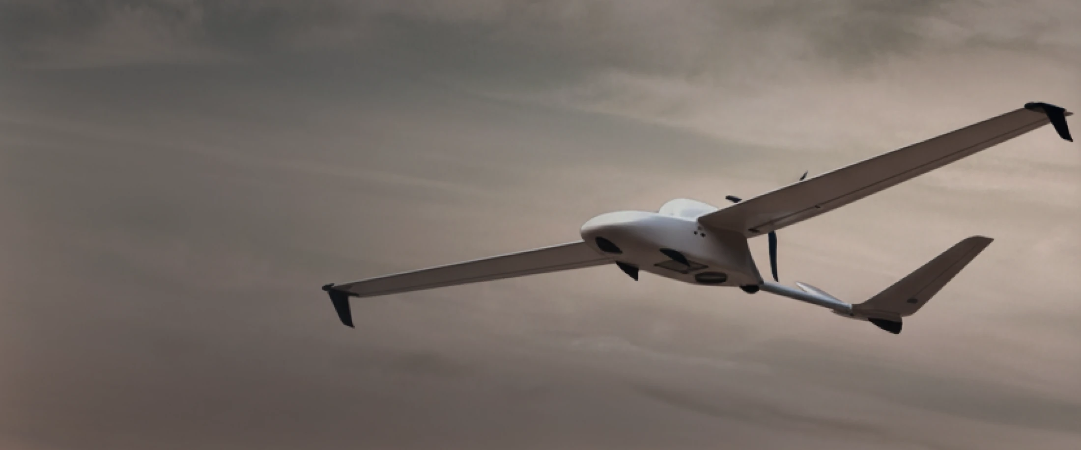
AERIAL PLATFORMS
Cetus X
An unmanned combat aerial vehicle launched from a catapult, and capable of striking targets at a distance of up to 120 km as a loitering munition or FPV carrier.
ISTAR SOLUTIONS
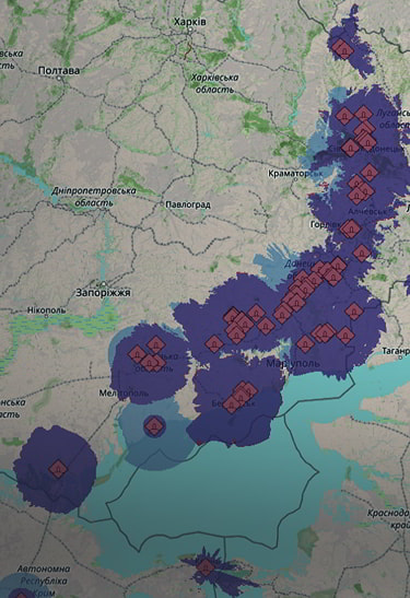
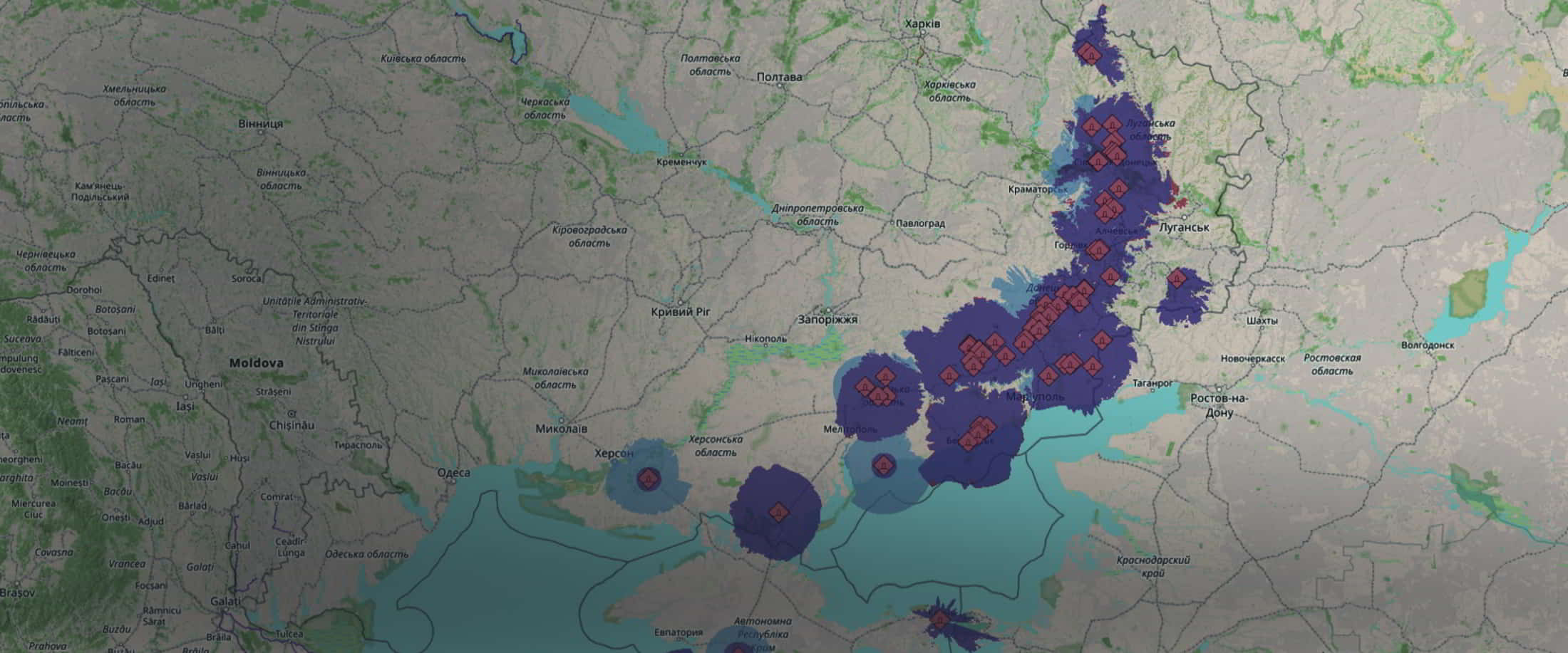
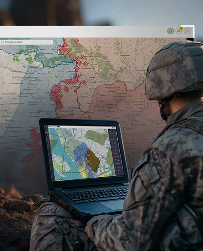
IRIZI
A comprehensive drone management ecosystem for threat-aware mission planning, real-time coordination and AI-powered analysis across all unmanned operations.
AERIAL PLATFORMS
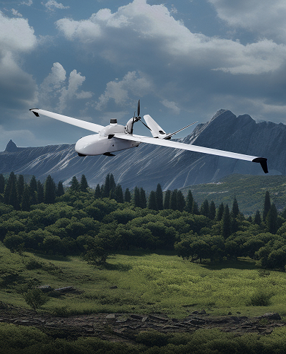
Cetus Lite
A high-performance and mobile fixed-wing UAV with a hand launch feature. Cetus Photo Lite performs photo and video reconnaissance for up to 2.5 hours within an operational radius of 50 km.
See full details
AERIAL PLATFORMS
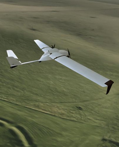
Cetus Photo
A universal UAV designed to perform a wide range of industry-specific tasks. Cetus Photo performs photo and video reconnaissance for up to 5 hours within an operational radius of 80 km.
See full details

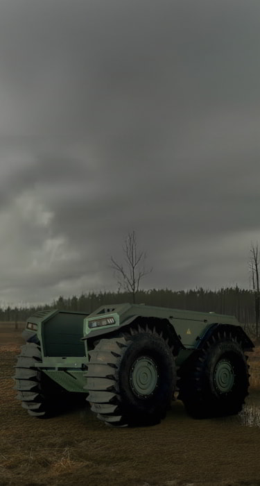
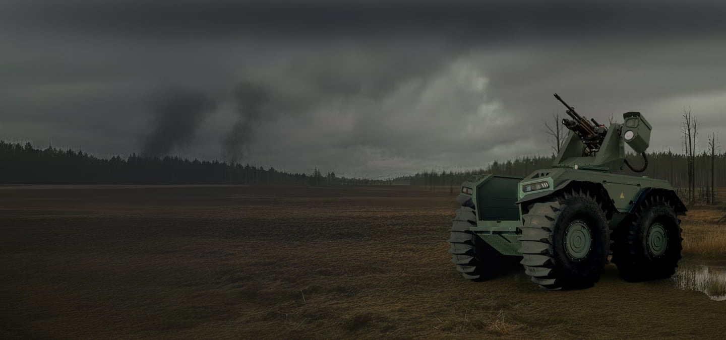
UNMANNED GROUND VEHICLES UNEX
UNEX
Amphibious all-terrain robotic platform with patented ultra-low-pressure tyres and payload capacity of up to 1,700 kg for demanding military missions.
See full details
AERIAL PLATFORMS
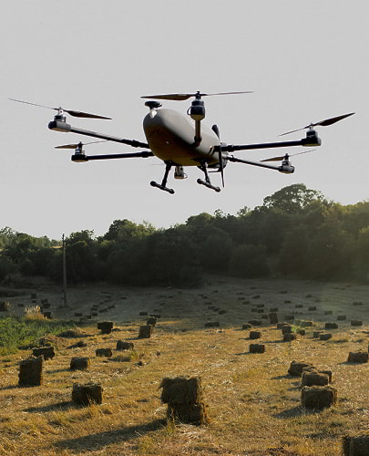
Beetle
A versatile multirotor VTOL UAV with exceptional flight performance that provides photo and video ISTAR and signal relay for FPV drones and secure communications systems.
See full details


Fields of Application

Border Surveillance
UAV systems extend the reach of border forces with persistent
aerial monitoring. High-resolution day & thermal sensors ensure early detection of unauthorised crossings or suspicious activity.

ISTAR
Long-endurance UAVs provide continuous ISTAR monitoring
with secure comms and anti-jamming GNSS. Covert flight modes deliver intelligence without exposing the mission.

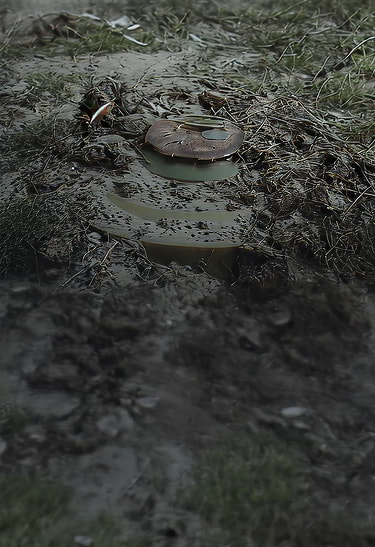
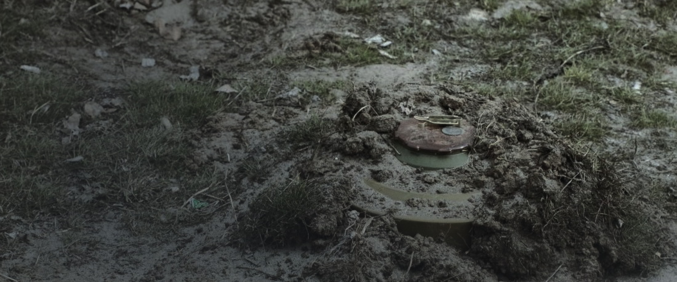
Demining
UAVs support mine clearance
by mapping hazardous areas remotely. Precise aerial data reduces risks for personnel
and accelerates safe ground operations.

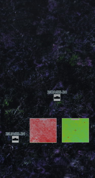
Battlefield Analysis
Thermal and visual imaging combined with AI analytics (IRIZI Focus) transform aerial data into actionable intelligence for operational planning and battlefield assessment.
Our Partners
and Clients


Ministry of Internal Affairs of Ukraine

Ministry of Defence of India

State Border Guard
Service of Ukraine

Guyana Defence
Force

Ukrainian
Ground Forces
Become a Strategic Partner
Join our global network of defenсe technology leaders and contribute to the future of security solutions